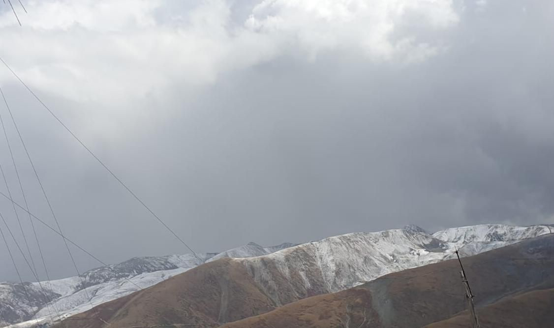
Srinagar: Minimum temperatures across Jammu and Kashmir and Ladakh fell further on Thursday, as the region approaches the 40-day-long harshest cold period, Chillai Kalan, beginning December 21, coinciding with forecasts of snowfall over Kashmir.
Reports said that several places in Kashmir Valley recorded sub-zero temperatures, with Zojila Pass experiencing the lowest at -17.0°C. Other notable temperatures include Awantipora at -3.8°C, Pulwama at -3.2°C, and Pampore at -1.8°C. Srinagar registered a minimum of 0.2°C, while Qazigund recorded 0.8°C. In contrast, Gulmarg and Kulgam were relatively warmer at 1.6°C and 2.0°C, respectively. In the Jammu division, Katra was the coldest at 12.1°C, followed by Jammu Airport at 11.5°C and Jammu city at 11.0°C. Banihal and Bhaderwah recorded 5.7°C and 5.0°C, while Rajouri dipped to 3.0°C. Ladakh also faced near-freezing conditions, with Leh at -3.4°C. A comparison with previous data shows a general decline in night temperatures across most areas. For instance, Srinagar fell from -1.6°C to 0.2°C, while Qazigund rose slightly from -3.0°C to 0.8°C. Pulwama and Pampore also saw increases in their minimum temperatures. In the Jammu region, Jammu city and Katra experienced notable rises, and Leh warmed from -6.3°C to -3.4°C. The Meteorological Department has issued an advisory for potential moderate to heavy snowfall in the higher reaches of Kupwara, Bandipora, and Ganderbal, particularly on December 21. Travelers are advised to plan their journeys accordingly and adhere to traffic and administrative guidelines. The weather forecast indicates light to moderate snow in higher areas of the Kashmir division and light to moderate rain in the plains on the night of December 20, continuing into December 21. Scattered light rain or snow is expected on December 22, with no significant precipitation anticipated until December 31. Two back-to-back Western Disturbances are expected to affect Jammu and Kashmir from Saturday to Tuesday, bringing snowfall to higher elevations and light rainfall in the plains. Dry and cloudy weather is forecasted for Thursday and Friday, with mostly dry conditions on Saturday. However, some higher-altitude areas may experience light snowfall. The first Western Disturbance is anticipated to impact the region from Saturday night, with precipitation beginning in the higher reaches, while the second system is expected to join on Monday, prolonging snowfall in north Kashmir. Snow accumulation is likely to vary from light to heavy in elevated areas, while plains may receive light rainfall. Tourist spots like Gulmarg and Sonamarg are expected to witness light to moderate snowfall. In the Jammu division, the plains are likely to experience mostly cloudy weather with light rain, while the middle and higher reaches may see light to moderate rainfall and snowfall, respectively. Overall precipitation is not expected to be high, but cold temperatures could lead to significant snow accumulation above 3,200 meters. Flight operations are anticipated to remain unaffected, air pollution levels may decrease, and the risk of forest fires could diminish.


