Heavy snowfall witnessed in Shopian, Zojila, police assist stranded residents& patients
“Another Western Disturbance on Feb 1–2; Admin issues heavy avalanche warnings to many distts”
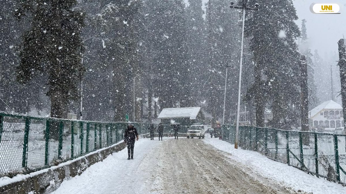
Srinagar: The second heavy snowfall of the season in Jammu and Kashmir brought normal life to a halt on Tuesday, with air, rail, and road services suspended due to poor visibility and severe weather conditions.
As per reports emanating from different areas of Kashmir Valley snowing started late Monday night in the Valley, with South Kashmir areas, including the Shopian plains, receiving heavy snowfall and a fresh accumulation of 14–15 inches.
Meanwhile, parts of North Kashmir, including Handwara, Gurez, Karnah, and Uri, also received heavy snowfall, disrupting local interior roads in these areas.
Official data revealed that Zojila received approximately three feet of snowfall, while Sonamarg recorded around two feet.
Gagangeer and Kulan Gund recorded nearly one and a half feet of snow, and the Kangan area in Ganderbal district saw about four inches of accumulation.
A senior official said administration teams are working around the clock to clear snow and reopen national and district roads across the Valley.
The Meteorological Department has forecast additional snowfall late Tuesday night, but conditions are expected to improve from Wednesday morning, with dry weather predicted for the next 48 hours.
Meanwhile, the India Meteorological Department (IMD) warned of fresh snowfall and possible avalanches in higher reaches of J&K over the next 48 hours.
A senior IMD official said the recent snowfall across the Valley has left snow depths ranging between 1 to 2 feet along the Pir Panjal range, from Kulgam to Kupwara. Gulmarg recorded 31 cm of snow in the lower reaches, while upper areas reported between 1.5 to 2 feet of accumulation.
“The snowfall that began yesterday is expected to reduce by Tuesday evening. By Wednesday morning, most parts of Jammu and Kashmir will see clear skies, though some residual snow may remain in isolated areas by Wednesday afternoon,” the official said.
He added that a Western Disturbance is likely to bring light to moderate rain or snow in parts of Kashmir between Wednesday afternoon and Thursday, with heavy snowfall possible in areas along the Kulgam-Kupwara axis.
The IMD has advised residents and visitors not to venture into higher reaches during the next 48 hours due to increased risk of snow avalanches. Locals in snow-prone areas have also been urged to exercise caution.
People travelling on national highways across the Union Territory have been asked to follow the guidance of law enforcement and local authorities to ensure safety, the official said.
The IMD predicted that another Western Disturbance is likely to hit J&K on February 1 and 2, bringing fresh precipitation to the region.
The Jammu and Kashmir UT Disaster Management Authority (JKUTDMA) has issued a high alert warning of a potential avalanche with a high danger level above 2,000 metres in Bandipora, Baramulla, Ganderbal, and Kupwara over the next 24 hours.
Residents and visitors have been advised to avoid avalanche-prone areas and strictly follow official safety instructions. In case of emergencies, people are urged to dial 112 for immediate assistance.
Tourists in Kashmir are making the most of the second snowfall this week, especially in the higher altitude areas. Places like Gulmarg, Pahalgam, and Sonamarg have turned into stunning winter landscapes, drawing large numbers of visitors.
Furthermore, police personnel have assisted numerous people in reaching safer locations and provided help during medical emergencies amid heavy snowfall across the Valley, including in Sopore, Handwara, Bandipora, Ganderbal, and Kulgam.


